 MapToNap
Sheets you can
pin up tonight.
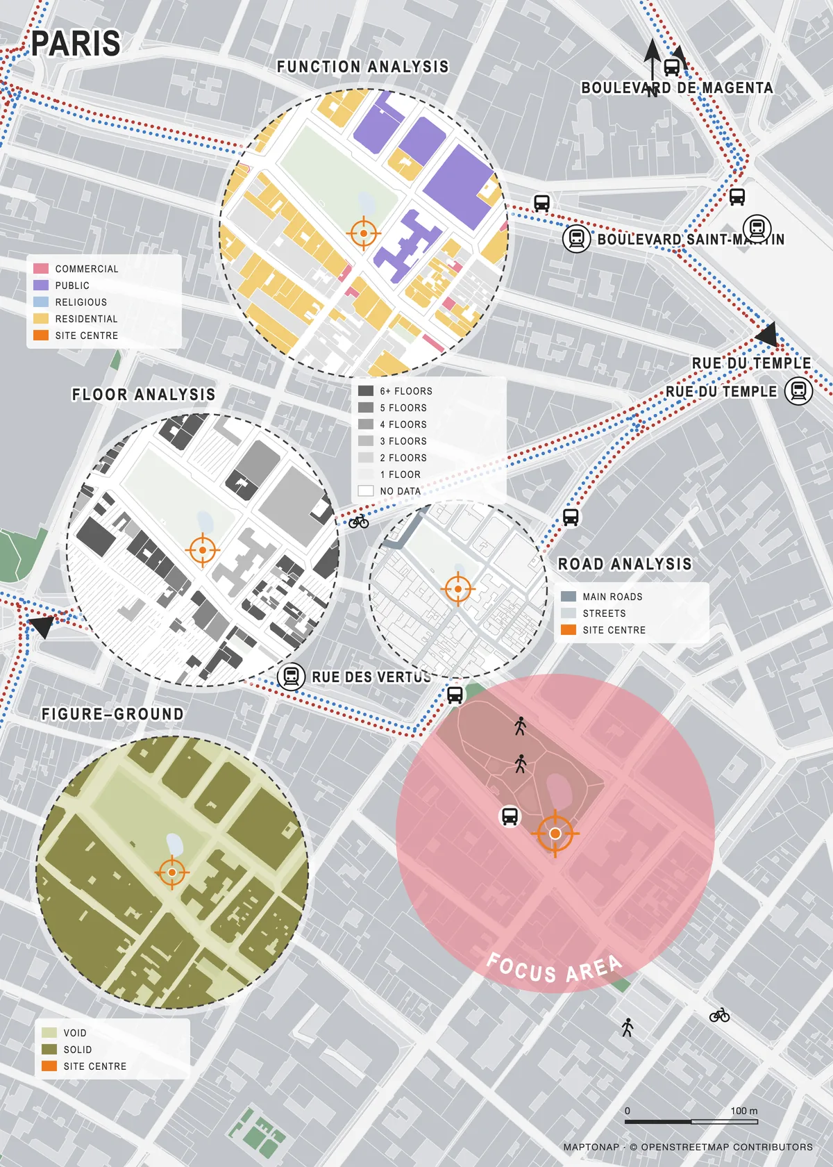
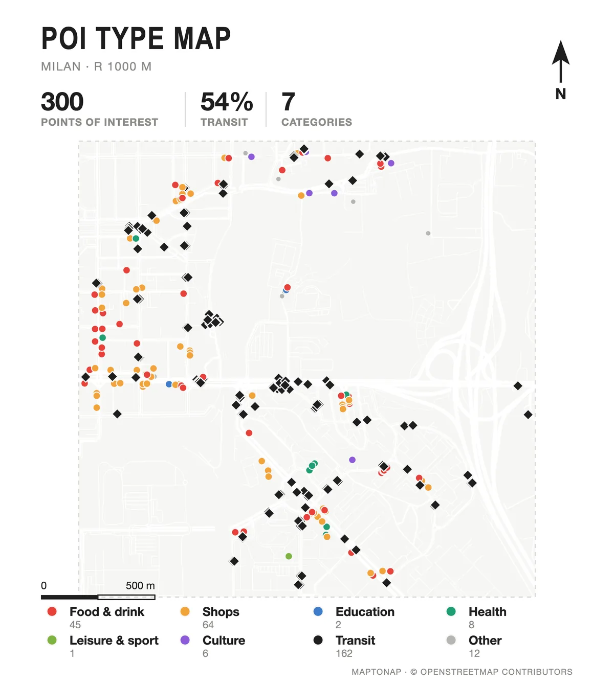
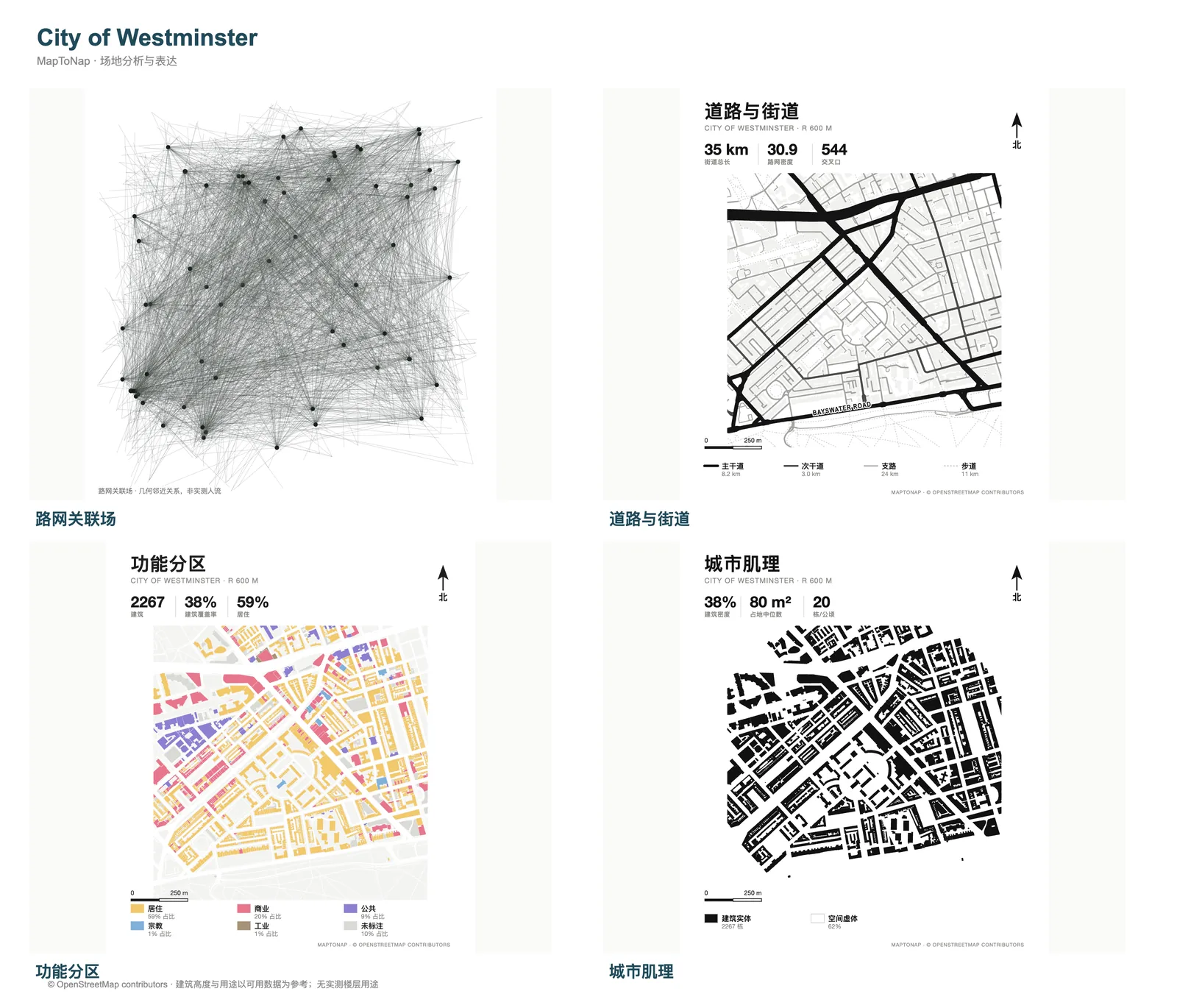
Straight out of MapToNap, untouched: 92 drawings and eight Deep Analysis studies.
From your site
to your design.
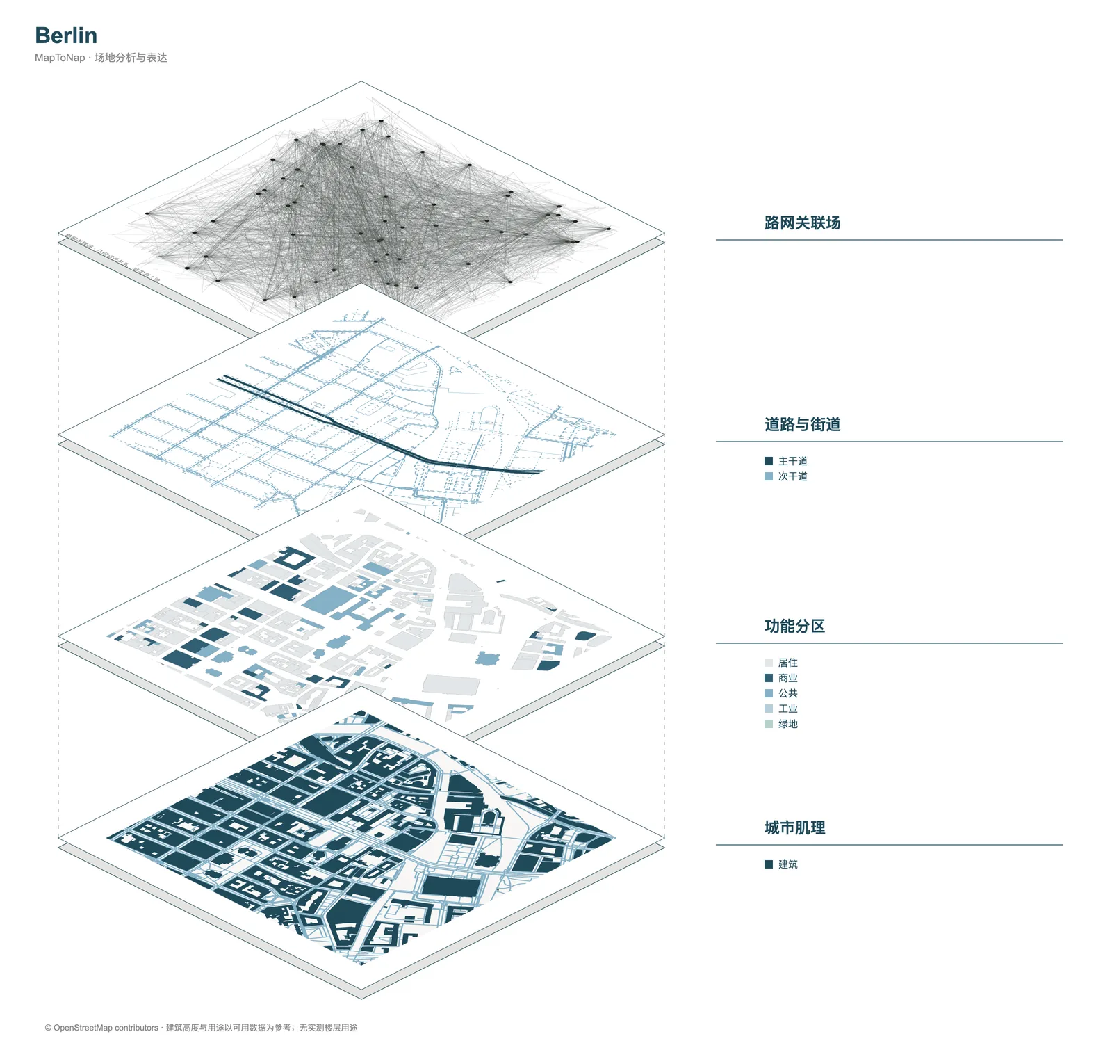
Mark the plot, pick what you are designing, and get five linked drawings and the boards. Everything stays editable.
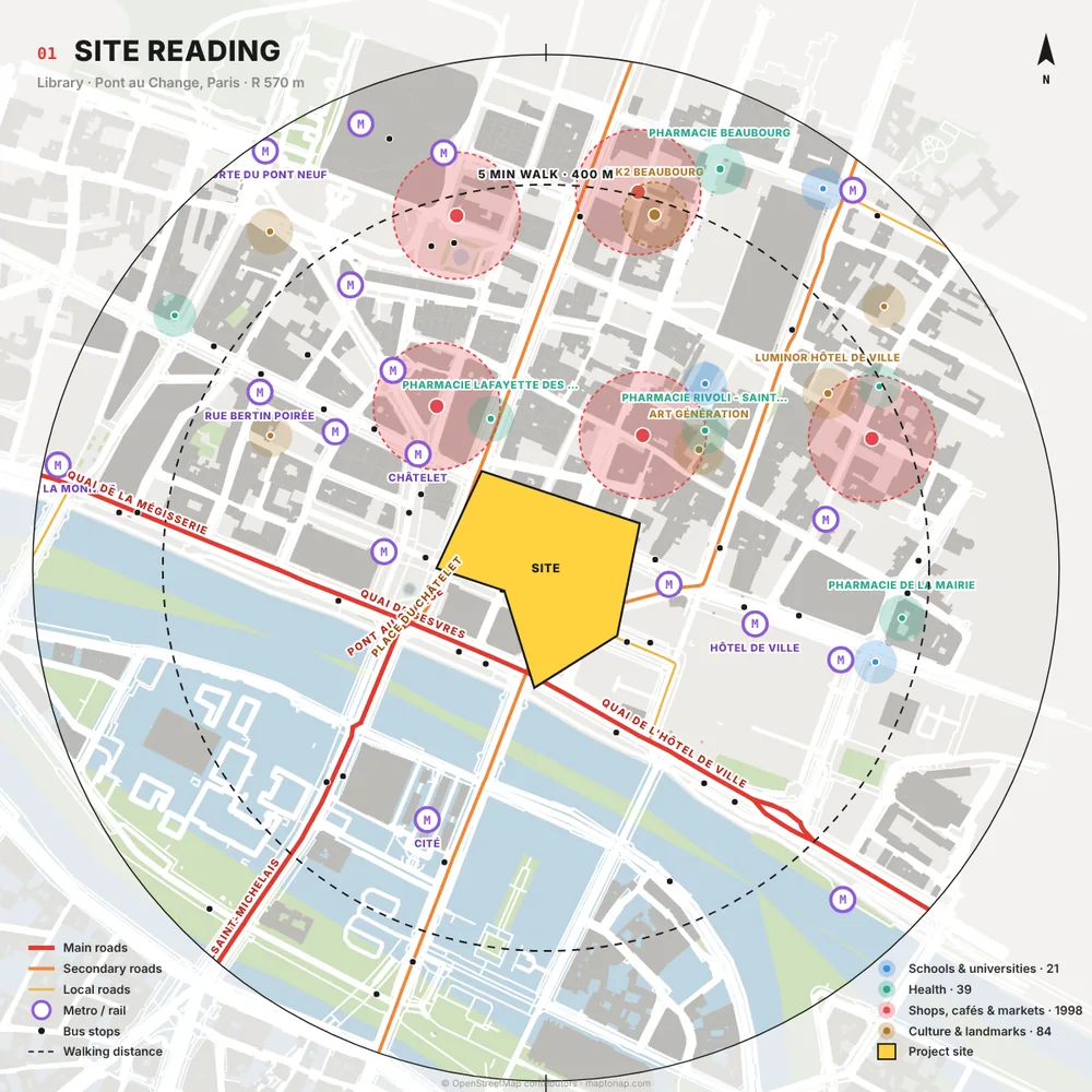
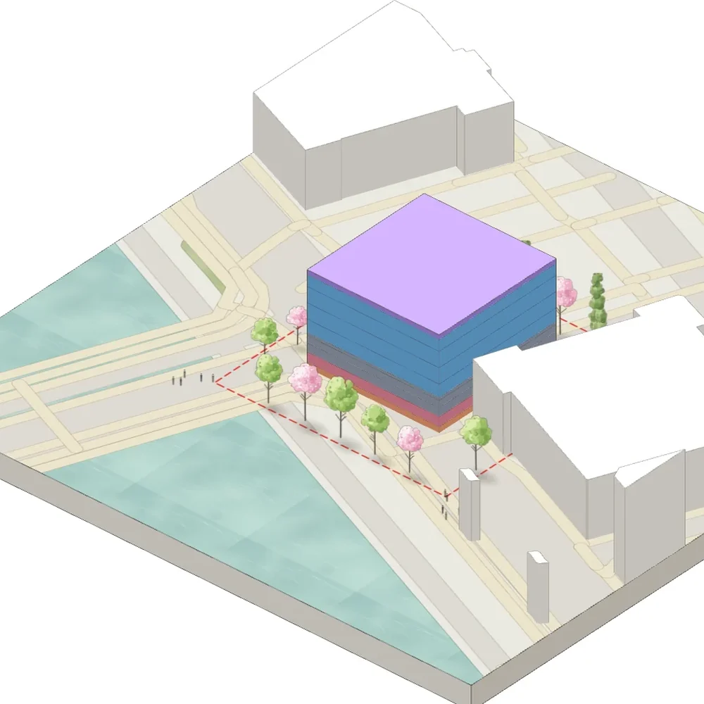
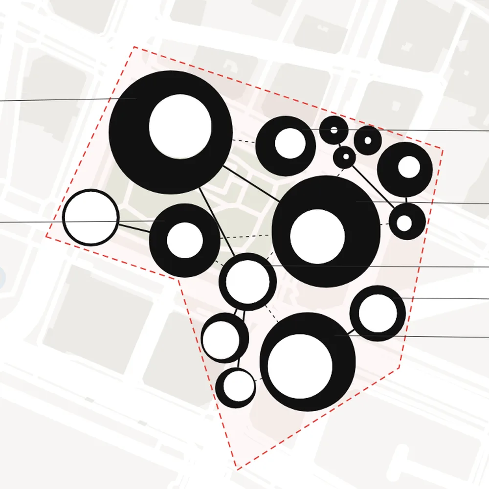
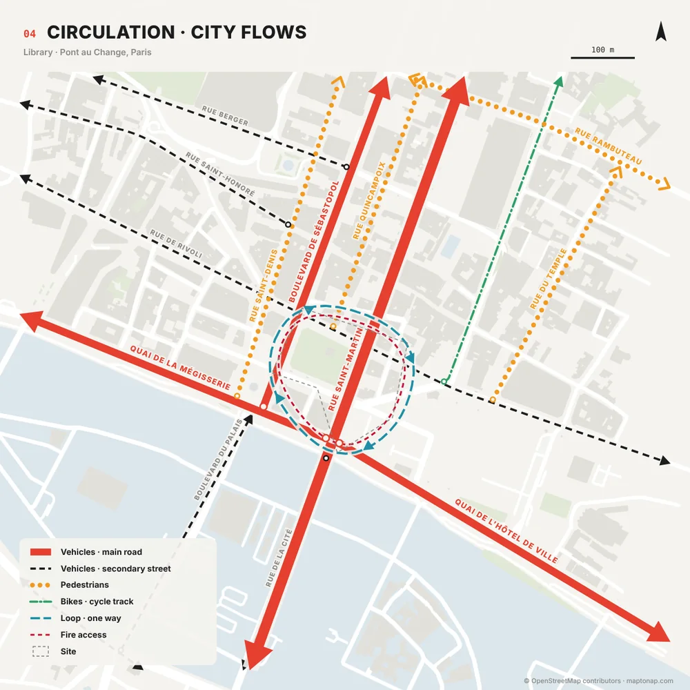
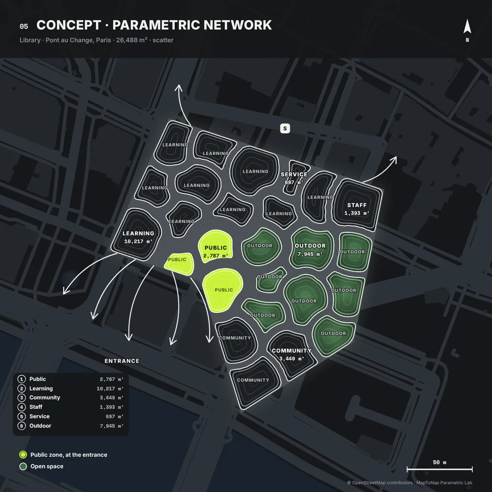
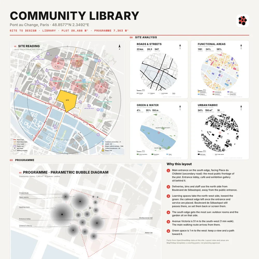
- 01Site readingEvery edge of your plot: street, noise, sun, transit and green.
- 02Site storyStreet photos around the site, on a timeline.
- 03ProgrammeSpaces for 17 building types, sized to your plot.
- 04CirculationVehicles, pedestrians, bikes and transit, traced from the streets. Every line editable.
- 05ConceptParametric zoning on the plot: four variants, every cell labelled.
- 05bMassing in contextThe programme stacked as coloured slabs among the neighbours, in six looks.
- 06BoardsAn A1 board, a PPT that explains each drawing, or simple A3 sheets.
How the architecture set works →
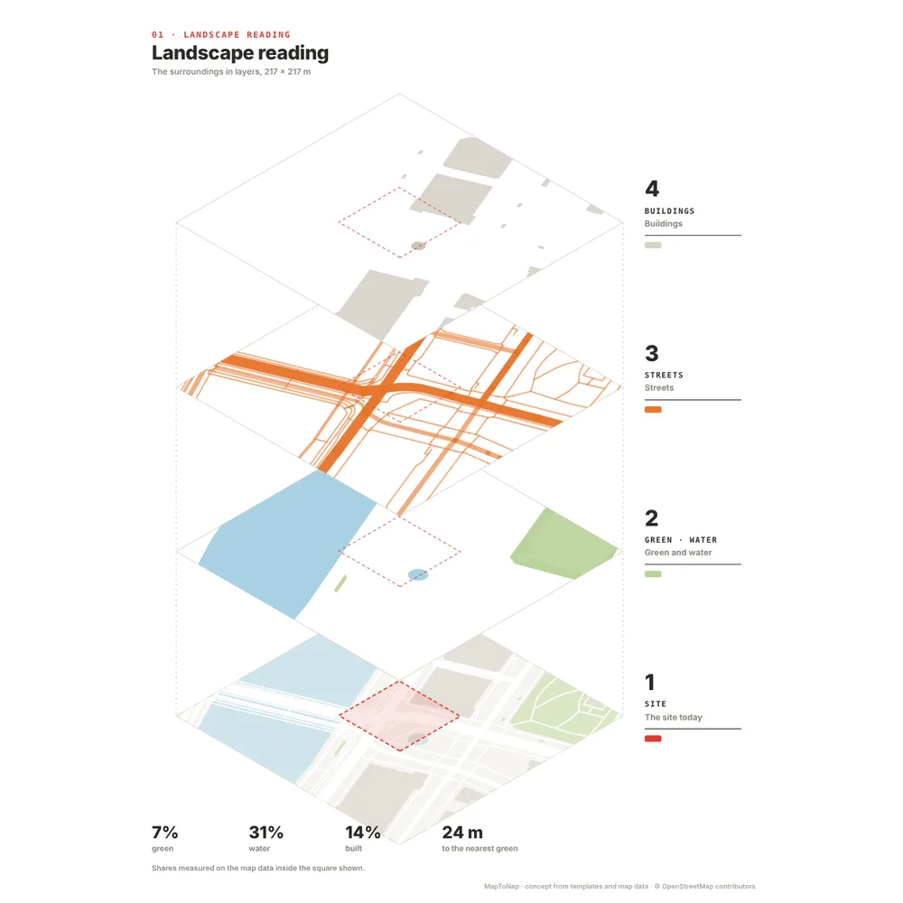
- 01Landscape readingWhat surrounds the plot, layer by layer.
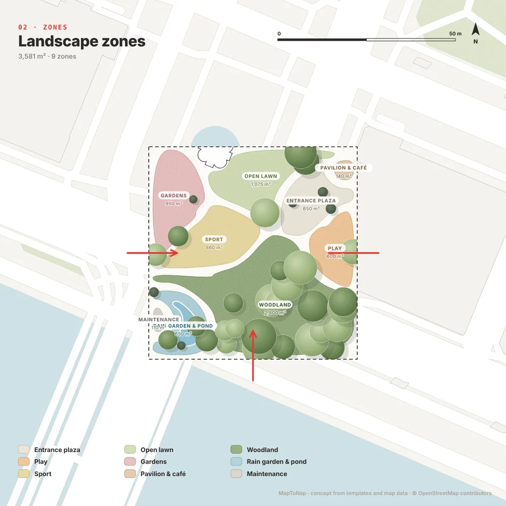
- 02ZonesThe programme laid on the plot: square, quiet zones, play and open lawn.
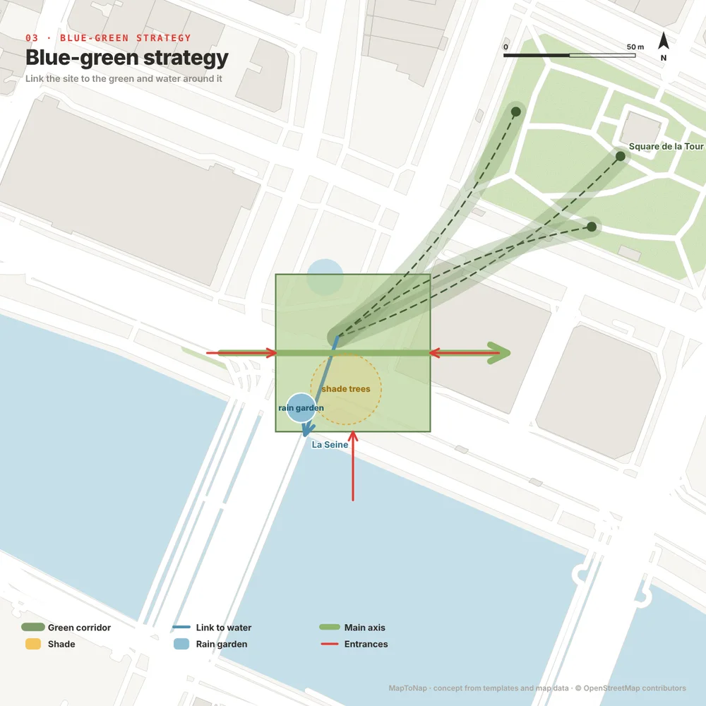
- 03Blue-green strategyGreen corridors, a link to water, shade and a rain garden.
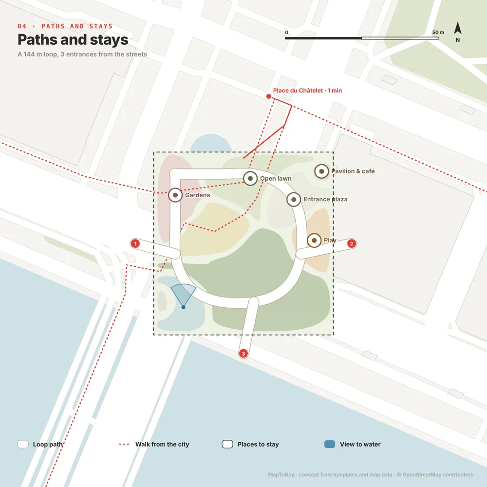
- 04Paths and staysA loop joined to the streets, with places to stay.
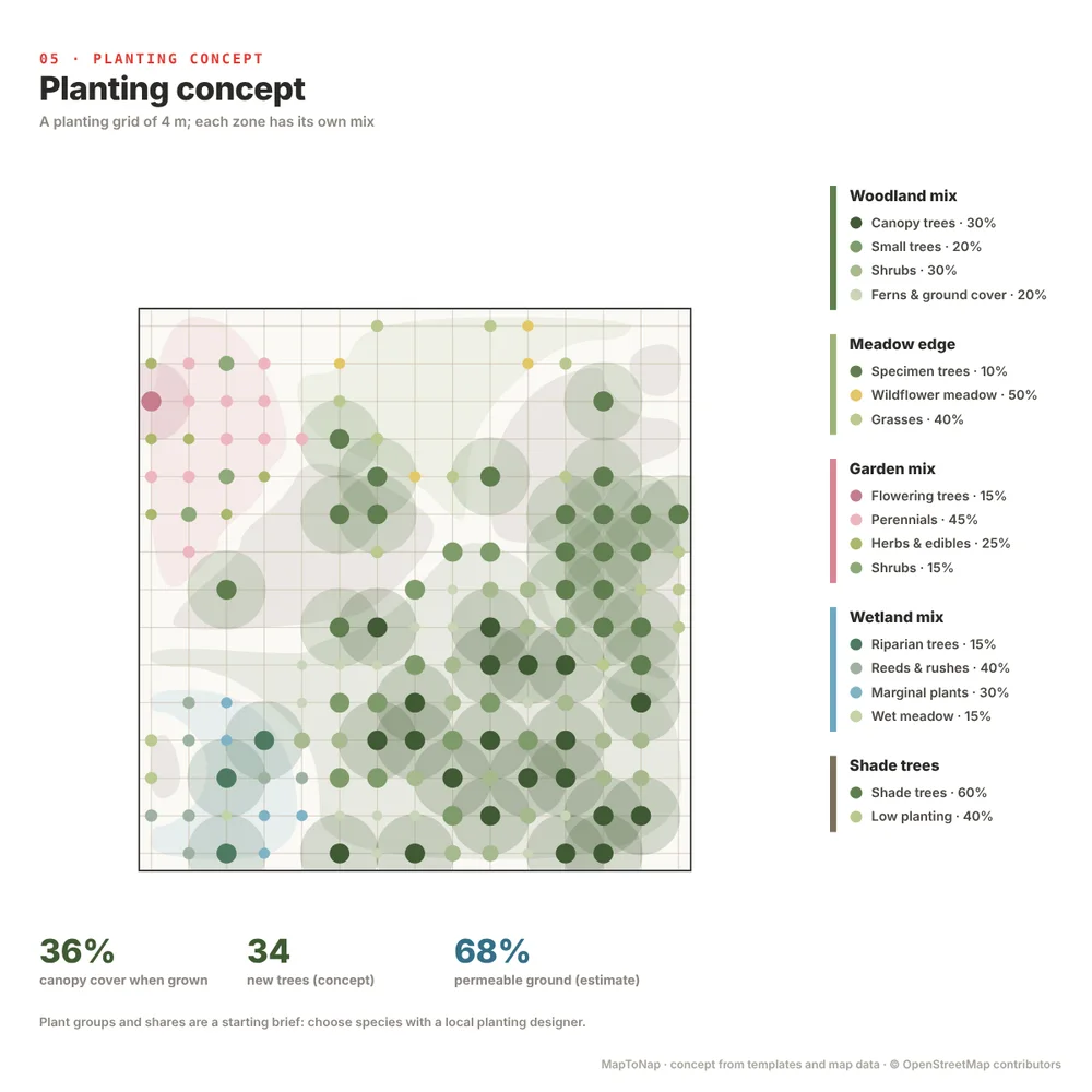
- 05Planting conceptOne planting mix per zone, with the canopy cover when grown.
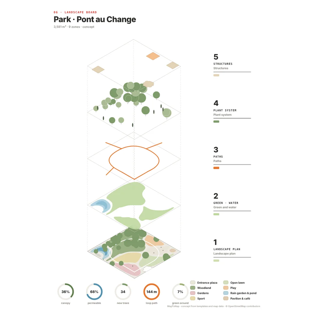
- 06Landscape boardExploded layers and a coloured plan with the key figures.
The site in 3D,
at true height.
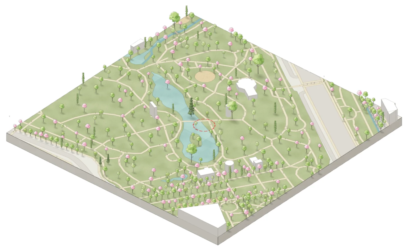
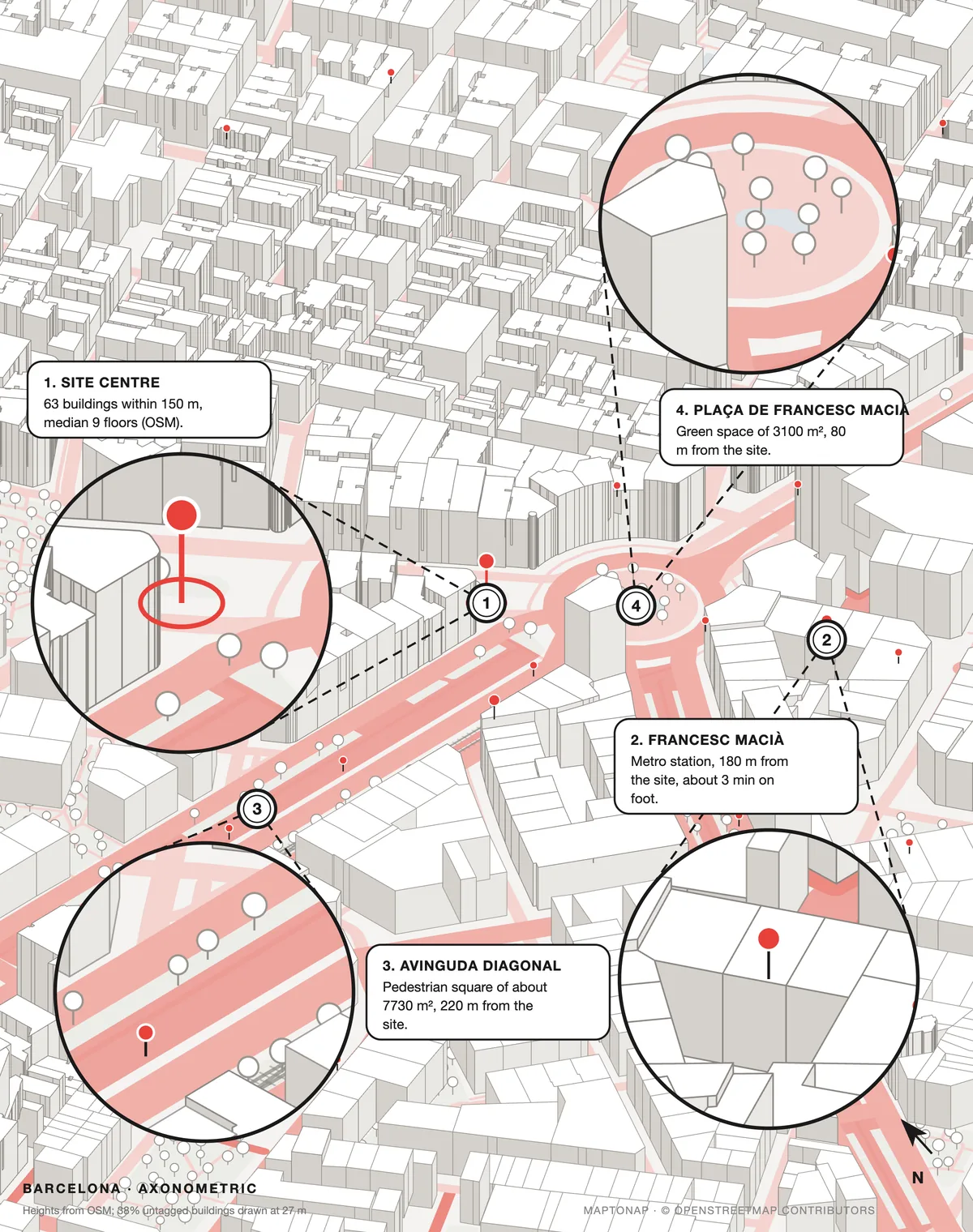
The same pin builds a 3D context model. Read it as an axonometric, a wind study or transit layers, take it into Rhino, or place your own design on it.
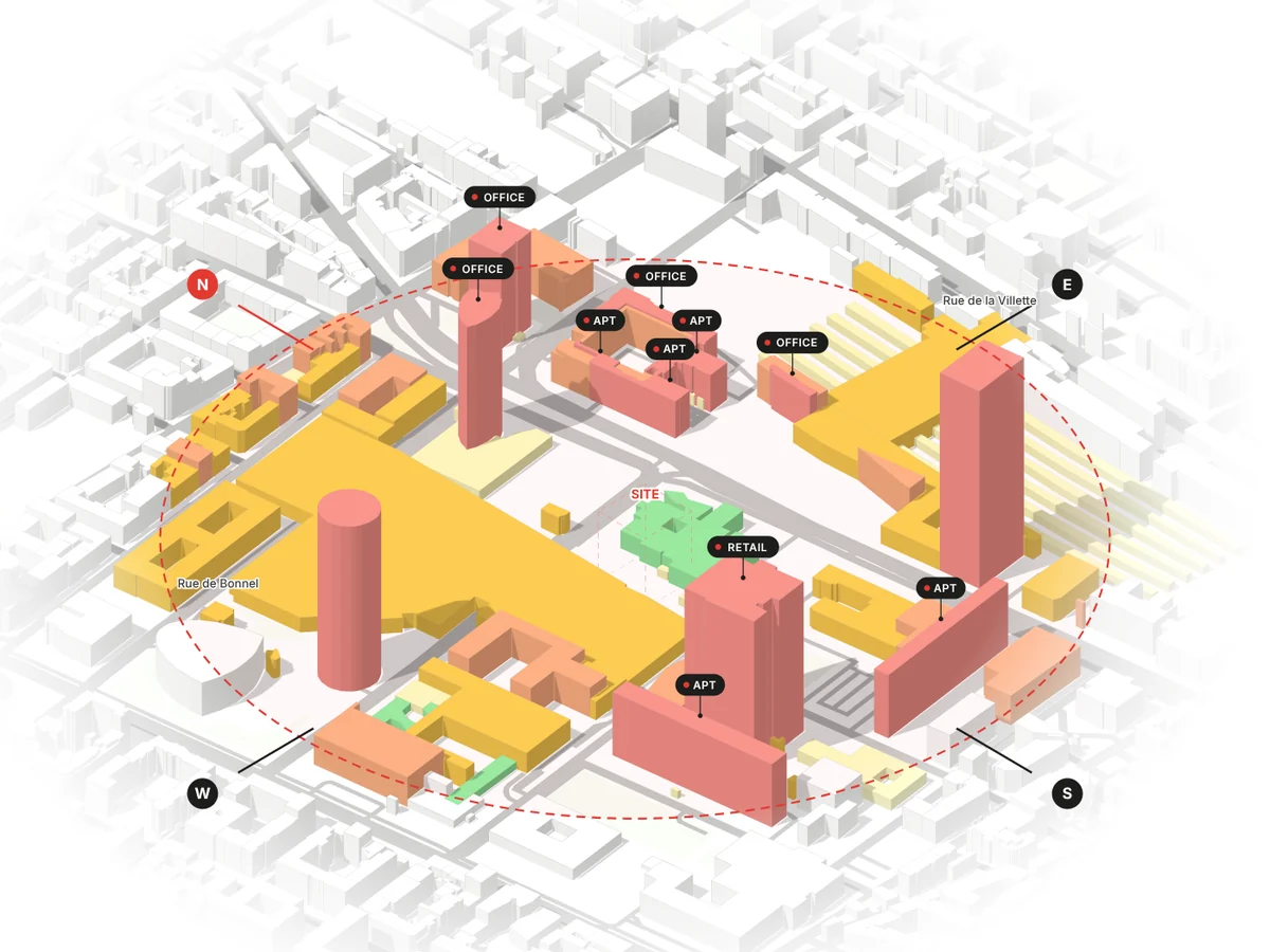
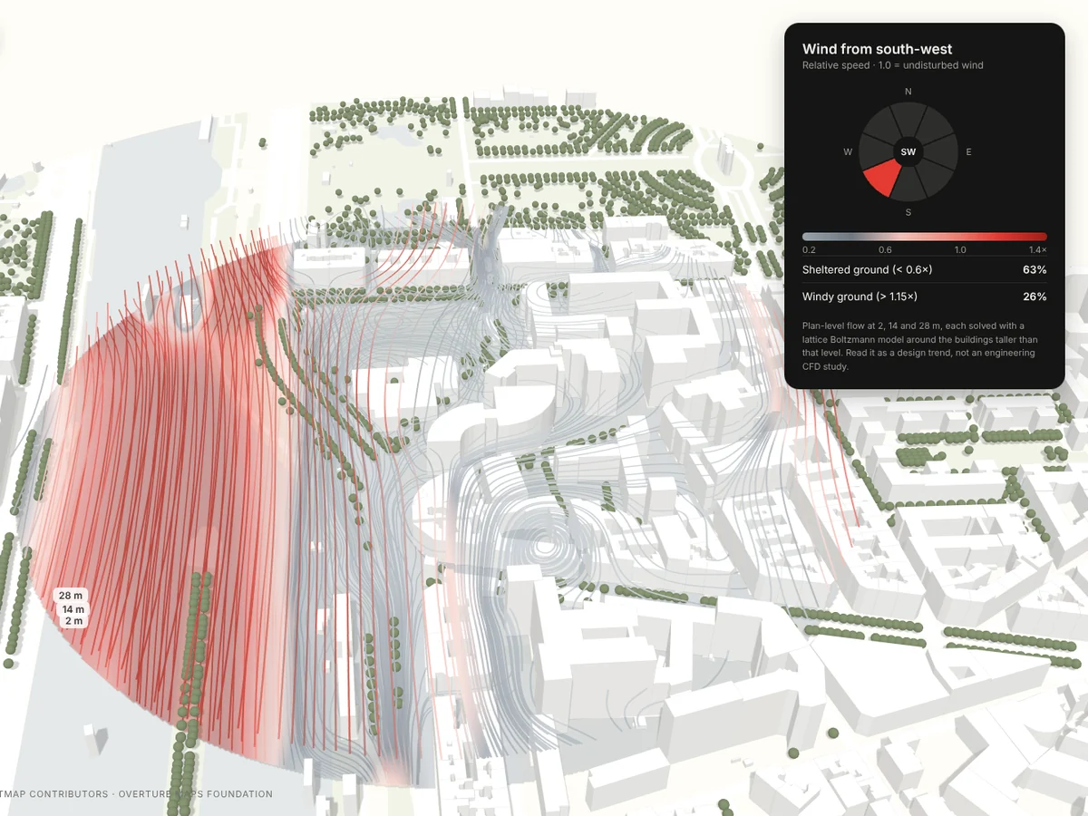
3D drawings are in the 3D tab. The urban context axonometric is free to try (watermarked).
Read a site
instantly.
Eight studies computed in your browser from open map data. Each ends with charts, conclusions and an A3 results sheet.
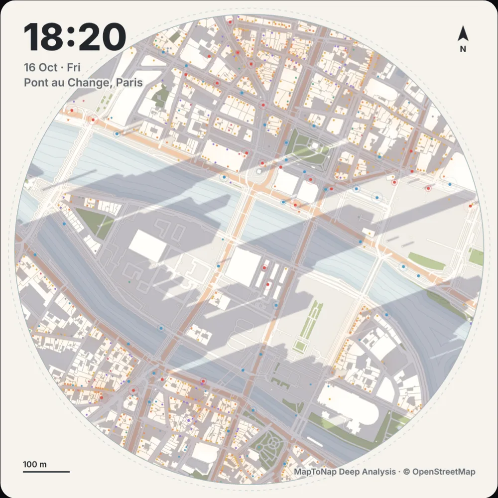
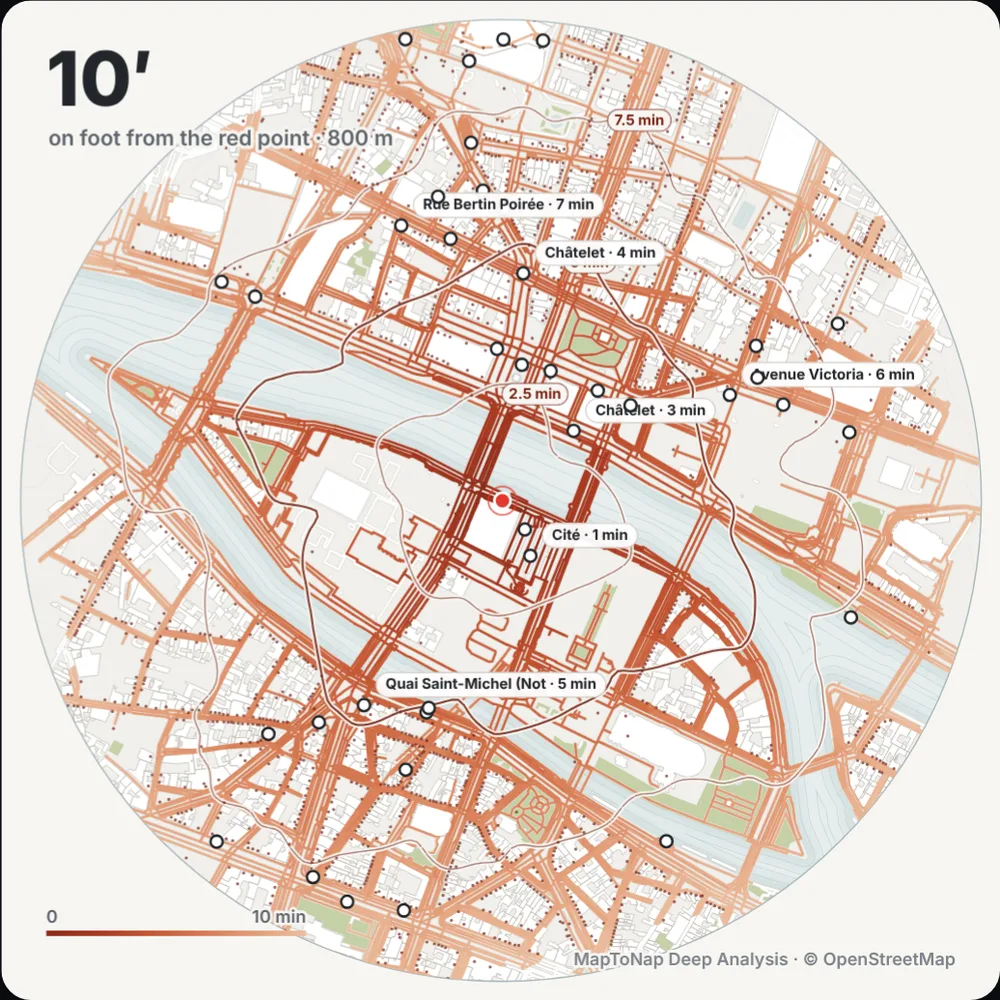
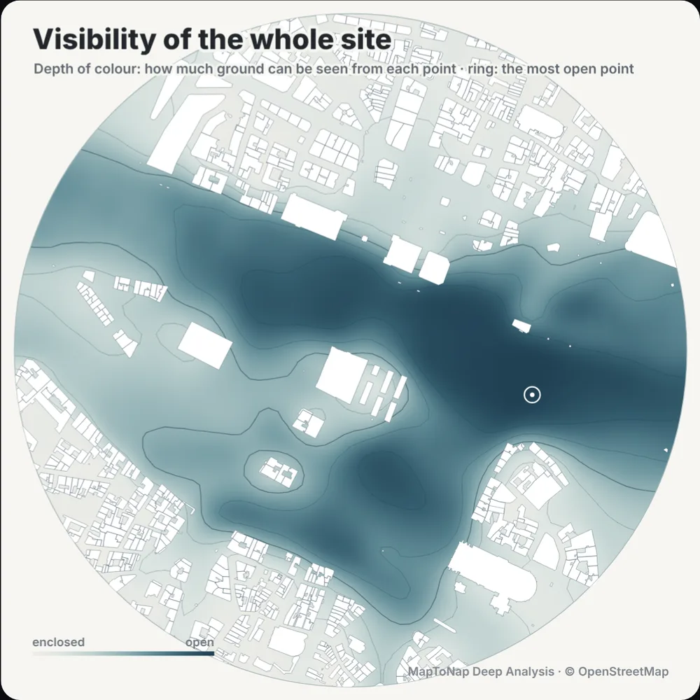
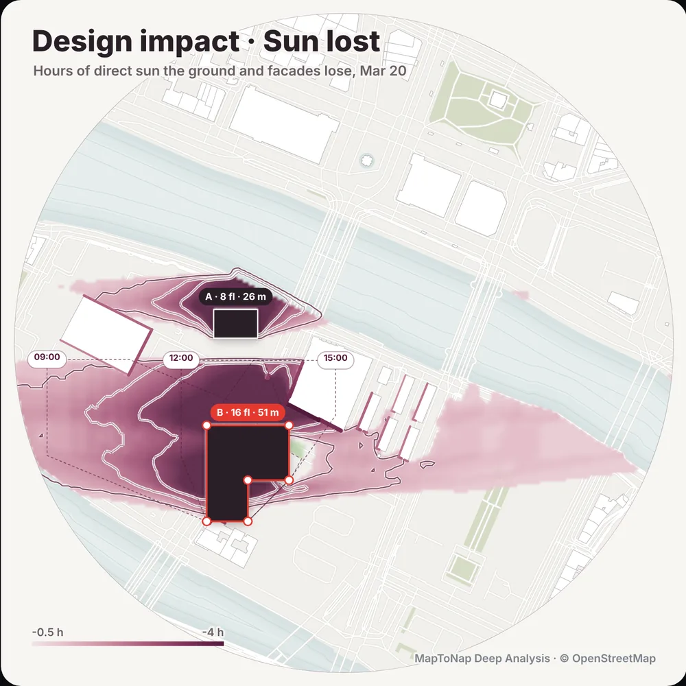
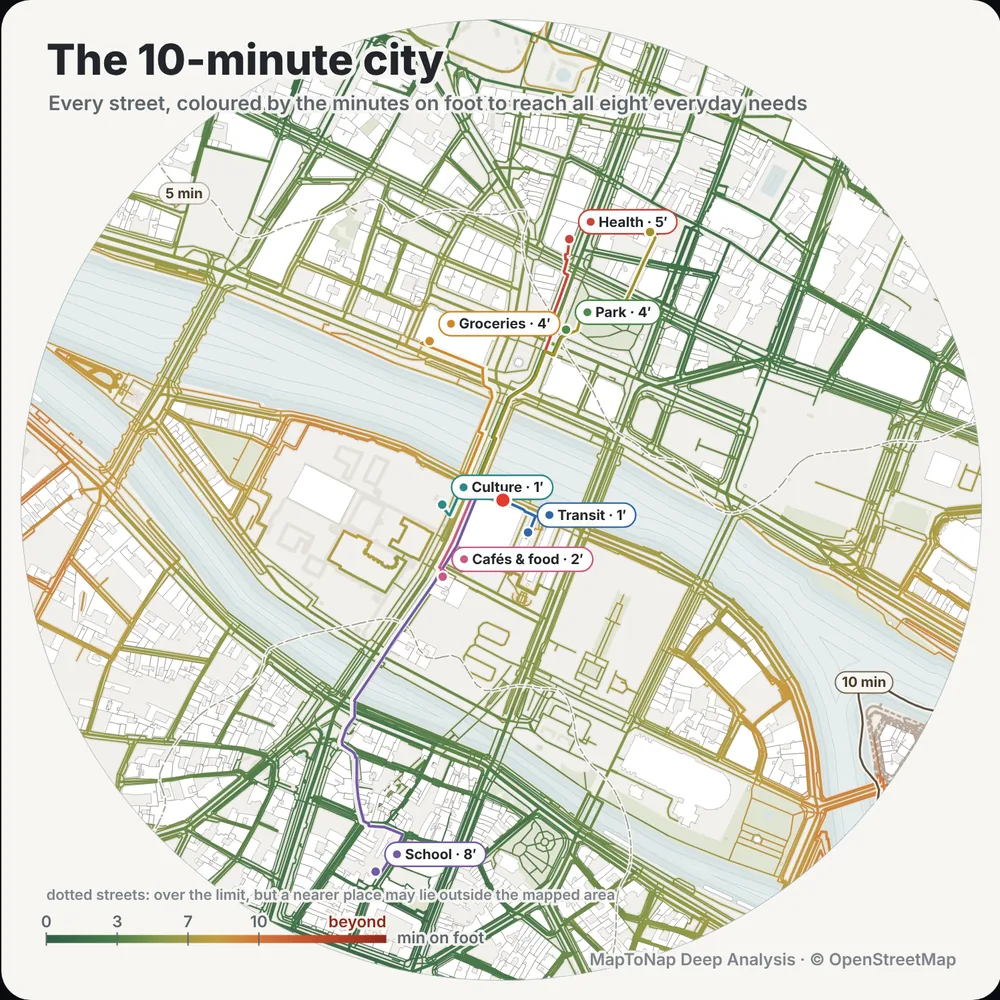
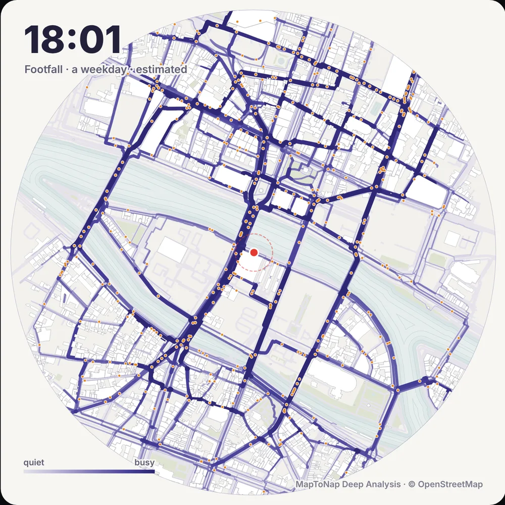
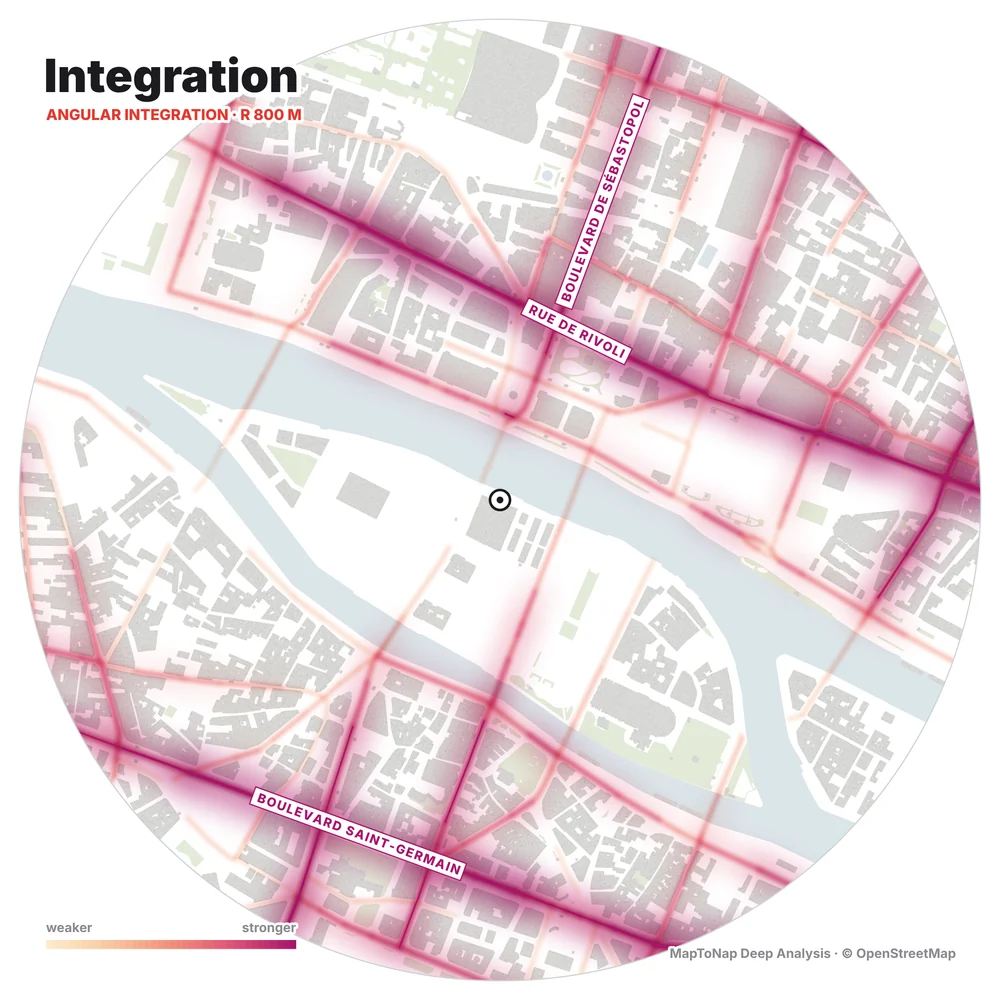
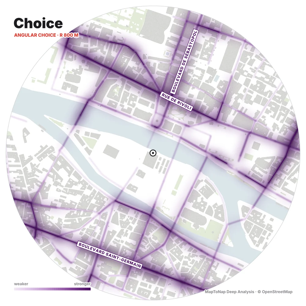
- 01A day in the site24 hours of sun, shadows, open shops and transit. Export a 20-second film.
- 02Walk pulseHow far you get on foot, minute by minute, along the streets.
- 03SightlinesDrag a point to see what is visible from it. One click maps the whole site (VGA).
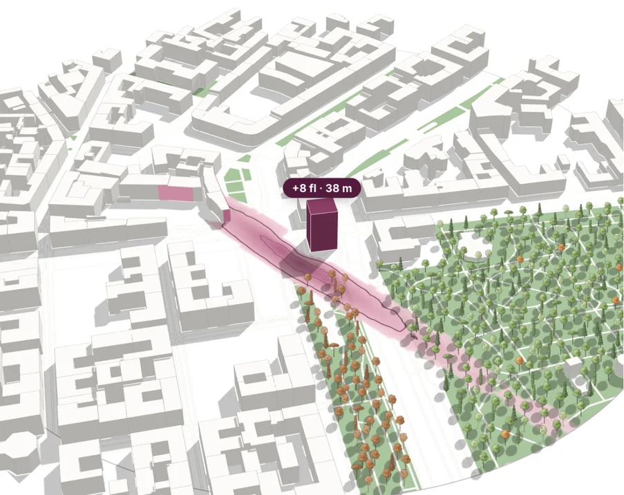
- 04Design impactDraw a block and see what it costs the neighbours: sun, views and walking detours.
- 0515-minute cityEvery street coloured by the minutes on foot to eight everyday needs.
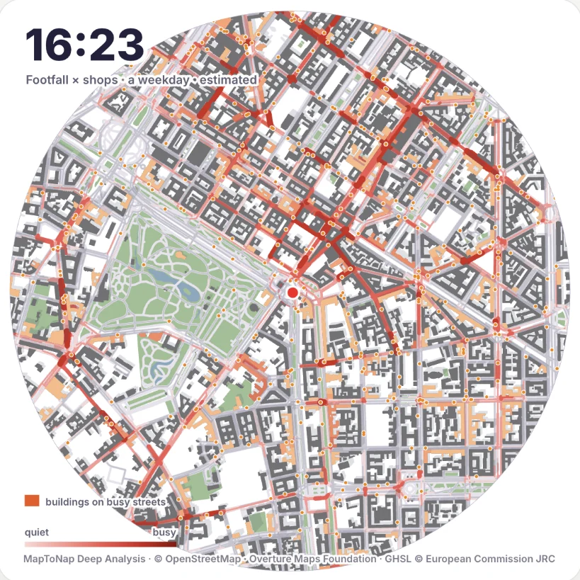
- 06FootfallAn hour-by-hour estimate of people on each street. Find the frontage for an entrance.
- 07Space syntaxIntegration and choice for every street, at 400, 800 or 1200 m.
No prompts, no image models. Every line is drawn from map, terrain and climate data, and stays editable. Where data is missing, the drawing says so.
Made so architects
can sleep.
For the all-nighters before reviews and the weekends spent tracing base maps. Every hour it gives back belongs to your design, your friends or your sleep.
- RestTime back, not more workGenerate the set, then close the laptop.
- AwarenessMake the hard work visibleWe talk openly about all-nighters, stress and burnout in architecture.
- PlanetEvery pass funds carbon removalA share of every purchase goes to permanent carbon removal.
- RecognisedRecommended by EUSAFEListed among the recommended urban design tools in the EUSAFE Digital Toolkit of the Faculty of Architecture, University of Ljubljana.
A pass for the project,
not a subscription.
Thirty days cover a studio deadline. Nothing renews by itself, and we remind you three days before a pass ends.
One plan for the office,
with a company invoice.
Max for every seat, a shared project library and your firm's name on the drawings. Monthly or yearly, cancel any time.
Pro
- 45 analyses, no watermark
- Editable SVG, vector PDF, A3 report
- Colour themes and custom legends
Max
- All 92 analyses + 3D model
- Rhino 3DM · OBJ · GLB export
- Presentation boards
- All nine design tools
- Deep Analysis · 8 studies
Max, a full year
- Everything in Max for 12 months
- Every tool added during the year
- Less than four 30-day passes
- +7 days for each friend you invite
Invite a classmate
They save 20% on any pass; you get 7 more days for each friend who buys.
Seats
- Max for each seat, 2 devices per person
- Company invoice
- Seat management, shared project library
- Your firm name and logo on drawings
Studio
- Max for 5 seats
- Company invoice
- Shared library of 100 projects, version history
- Your title block on drawings and boards
- Batch up to 3 sites
Office
- Max for 15 seats
- Company invoice
- Shared library of 300 projects
- Batch up to 10 sites, client links
- Priority support + online onboarding
Prices exclude VAT, added at checkout for your country. When a company pays for MapToNap or staff use it on company projects, a Business plan is needed. Compare Personal and Business →
No prompts.
All control.
Is this an AI image generator?
No. Every drawing is built from maps, open data and editable geometry, so you can change the composition, colours and relationships yourself. The 3D model at the top of this page is made the same way.
What happens after 30 days?
The pass ends by itself. Nothing is charged again, and we email you three days before. Your projects stay in your browser and the four free analyses keep working. Buy another pass, or a full year of Max, whenever you need it.
I bought before passes existed. Do I lose anything?
No. Every purchase made before 30-day passes stays permanent, exactly as you bought it.
Can I use the drawings commercially?
Yes. Every paid plan includes commercial use for your own projects, clients and publications. Keep the OpenStreetMap attribution on map-based drawings.
Buying for a company, with an invoice?
Business plans are made for companies: Max for every seat, a company invoice (prices exclude VAT), and a shared team library. See MapToNap Business.
What can I export?
Site Analysis exports PNG, editable SVG and vector PDF, plus an A3 report. Floorplan also exports DXF. 3D Site exports Rhino 3DM, OBJ and GLB.
Where is my work saved?
In this browser. Export a project backup before clearing browser data or moving to another device; your purchase restores anywhere with your code.
Do I need to install anything? Does it work on my phone?
No installation and no setup. MapToNap runs in the browser on any computer, tablet or phone, iPhone or Android: open maptonap.com/app, type an address and press Generate. The four free drawings need no account. 3D drawings and simulations run smoothest on a computer, which also gives you the most room for editing.
Is MapToNap free?
You can try it free: four drawings (roads, land use, green and water, urban fabric) and one drawing in 3D, with a watermark and no sign-up. Without the watermark and with all 92 analyses there are one-time passes: Pro €7.99 or Max €12.99 for 30 days, or a year of Max for €49. Nothing renews automatically.
Is MapToNap safe to use?
Yes. There is nothing to install and no account is needed to try it. Payments go through Stripe, so card details never reach MapToNap, and the site has no advertising and no tracking cookies. The drawings come from open, citable data: OpenStreetMap for buildings and streets, NASA POWER for climate.
Can the visual analysis use street photos?
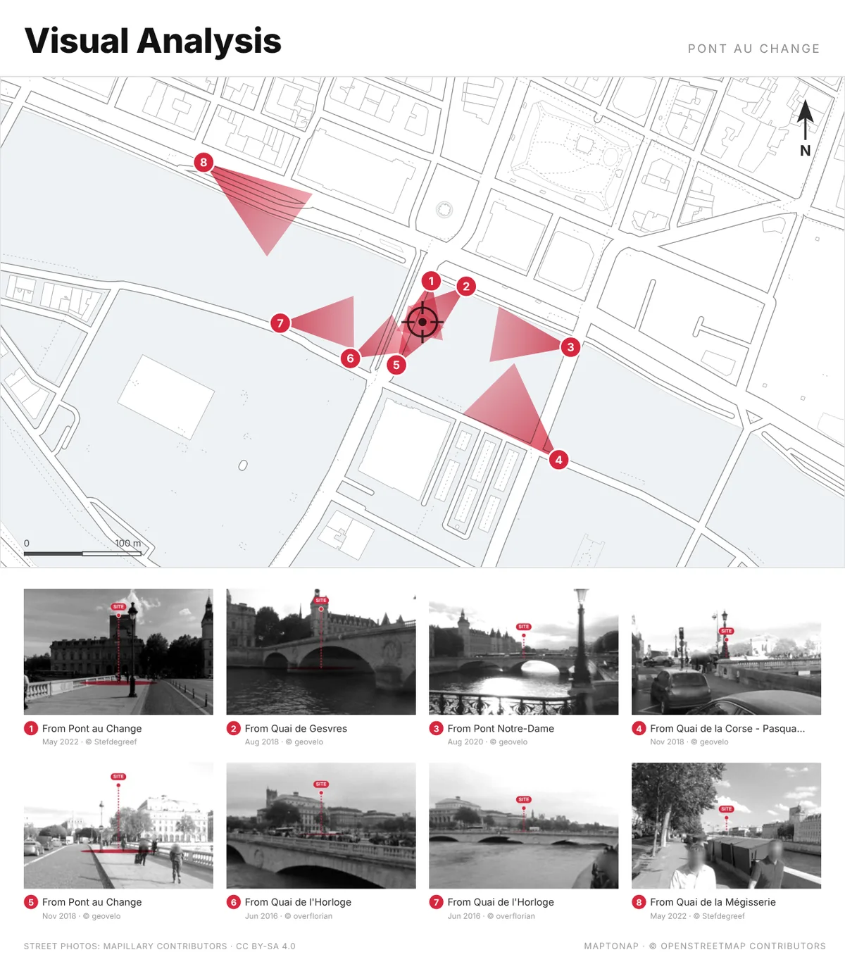
Yes. The Visual Analysis board (Max) draws numbered view cones on the plan and fills each with a street-level photo from Mapillary, taken where the site can really be seen past the buildings in front, with the site picked out in red. The photos are CC BY-SA 4.0 and every photographer is credited on the board.
What is Deep Analysis?
Eight studies of the site that go beyond diagrams: 24 hours of sun and shadow, walking isochrones, isovists and visibility graph analysis (VGA), the impact of a proposed design on sun, views and walking, the 15-minute city, an hour-by-hour footfall model, space syntax (how well each street is connected) and WHAT IF?, a 3D model of the site where you change a building, close a street or add a block and measure what changes. It runs in your browser on open map data, is part of Max and is free to try on the Paris sample.
Who makes MapToNap?
MapToNap is an independent tool for architects, landscape architects, planners and students. Its diagrams follow the conventions used on review and competition boards.
From map
to nap.
92 drawings and one A3 board before midnight. Then close the laptop.