What is an isovist?
The set of all points visible from one position, drawn in plan. It is a standard way to study views, openness and exposure in architecture and urban design.
Views shape where a building opens up and where it closes. In MapToNap’s Deep Analysis, drag the red point across a site and the lit area shows everything you can see from there, cut by the real buildings around it; the façades facing you turn red. Architects call this field of view an isovist. You can also map visibility across the whole site at once to find its most and least exposed places.
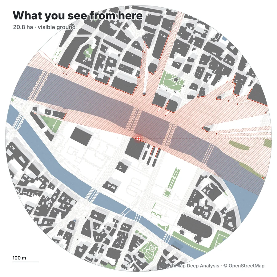
The area you can see from the point, in hectares, drawn as the lit shape on the plan.
How far the furthest unobstructed view reaches — along a river or a boulevard it can run beyond 500 m.
How many buildings and how many mapped places face the point, with the visible façades highlighted.
Search an address or click the map, or start with the Paris sample.
Move the red point and watch the visible area update; switch to the whole-site map to compare positions.
Place openings, entrances and public spaces where the views are, and keep private rooms out of the most exposed spots.
The set of all points visible from one position, drawn in plan. It is a standard way to study views, openness and exposure in architecture and urban design.
The building footprints from the map data around the site. It is a plan-level study of what the buildings block, meant for early design rather than a detailed view assessment.
Yes. Every Deep Analysis study is free on the Paris sample. On your own site Deep Analysis is part of Max.
Yes. Map visibility across the whole site shows how much can be seen from every point, so you can compare positions at a glance.