Which 3D formats can MapToNap export?
Rhino 3DM, OBJ and GLB. The exported model uses meters and a local origin.
Search a real location, draw the area you need, choose the layers, then build the surrounding architectural context in your browser. Export the model as native Rhino 3DM, OBJ or GLB — and use the same site for 39 editable analysis diagrams.
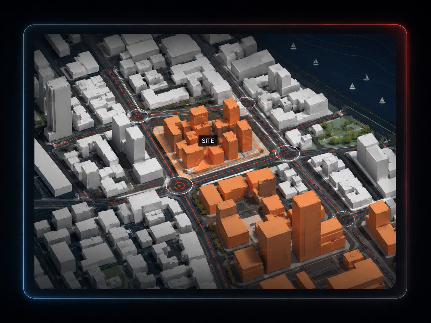
Enter an address or place and move straight to the real site instead of assembling GIS files first.
Choose a rectangle or circle and keep the context as tight as your project needs. The 3D exporter currently supports selections up to 4 km².
Include buildings, terrain, roads and paths, water, green areas and low-poly trees. Building heights may be estimated when source data is incomplete.
Orbit the generated model, check the context, then export Rhino 3DM, OBJ or GLB.
Surrounding building massing comes from map footprints and available height data. Missing heights may be estimated, so the model is context — not a survey.
Add a terrain mesh from regional elevation data and control the terrain exaggeration in the 3D workspace.
Keep roads and paths, water, green areas and trees as separate context layers instead of receiving one fused mesh.
Native .3dm export in meters. Objects are organised under MapToNap layers so you can isolate context inside Rhino.
A simple exchange format for SketchUp-compatible workflows, Blender, 3ds Max, Cinema 4D and other mesh software.
A compact binary glTF file for quick viewing, real-time workflows and lightweight 3D handoff.
With an active MAX licence, up to three 3D model exports per 24 hours are included.
Larger supported selections are €2 per export and do not use the daily included quota.
Large-area 3D file export is not available yet. The workspace can record demand for this size.
From the same real location, generate roads, land use, green and water, density, climate, topography, accessibility and other architecture analysis diagrams.
Continue into site concept, strategy, flow, bubble, masterplan, parti and other early-design tools.
Move into floorplan/AXO, plan and elevation rendering and portfolio layout without rebuilding the project context from scratch.
Rhino 3DM, OBJ and GLB. The exported model uses meters and a local origin.
Buildings, terrain, roads and paths, water, green areas and trees. Availability depends on the source data around the selected site.
No. It is an architectural context model. Building heights can be estimated and terrain comes from regional elevation data, so it should not replace a survey or engineering dataset.
3D Site requires an active MAX licence. With MAX, selections up to 1 km² include three exports per 24 hours. Supported selections from 1 to 4 km² cost €2 per export.
Yes. MapToNap can generate 39 site-analysis diagrams from the same project location, so the 3D model and the analysis set can start from the same context.
No. The geometry is built from map data, elevation data and rule-based model generation, not from an AI image prompt.