Home / Deep Analysis / Space syntax analysis
Space syntax analysis online

Space syntax integration and choice maps for any site, in your browser

Space syntax measures how each street sits in the network around it, from the street geometry alone. MapToNap runs an angular segment analysis of the real street network around your site and draws two maps: integration, the streets easiest to reach from everywhere around with few turns, where pavements and shops are usually busiest, and choice, the through-routes that the most journeys pass. Pick a radius of 400, 800 or 1200 m; it is computed in a few seconds, with no install and no network to draw by hand.

Live OpenStreetMap dataAngular segment analysisR 400 · 800 · 1200 mPNG export
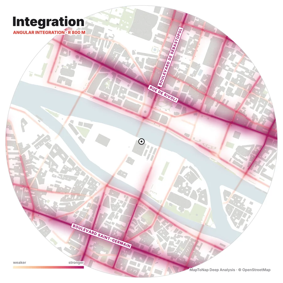
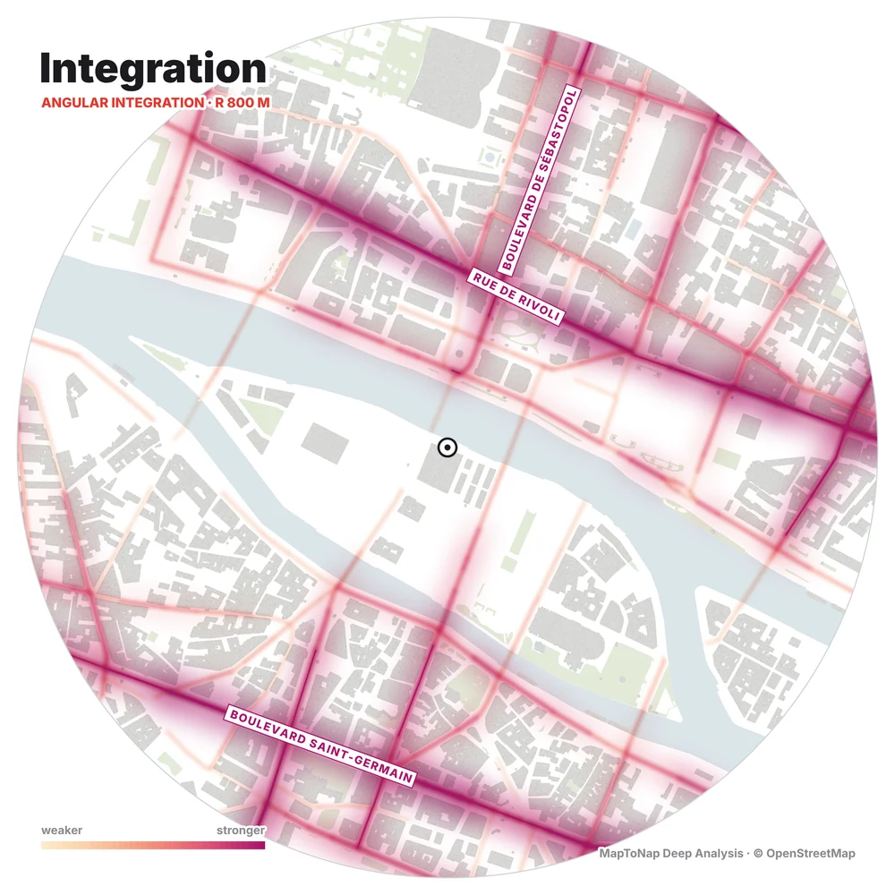
Angular integration at 800 m around Pont au Change, Paris, computed in MapToNap
What you get

Two measures, three radii, one graphic language

Integration (NAIN)

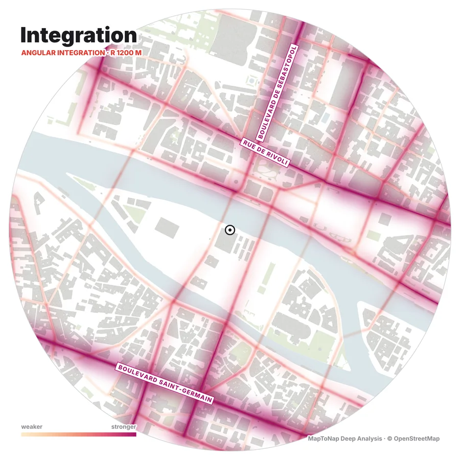
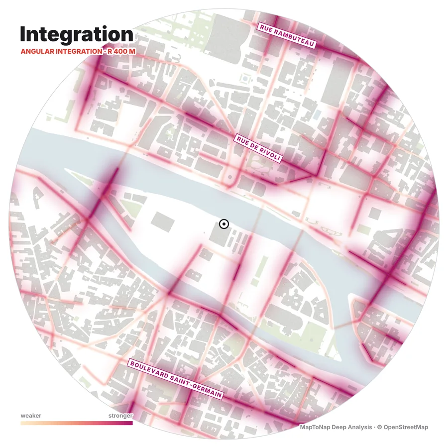
How few changes of direction it takes to reach a street from all the streets within the radius. The warm glow follows the best-connected streets; the strongest are named on the map.

Choice (NACH)

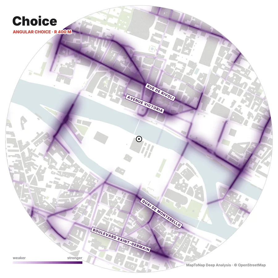
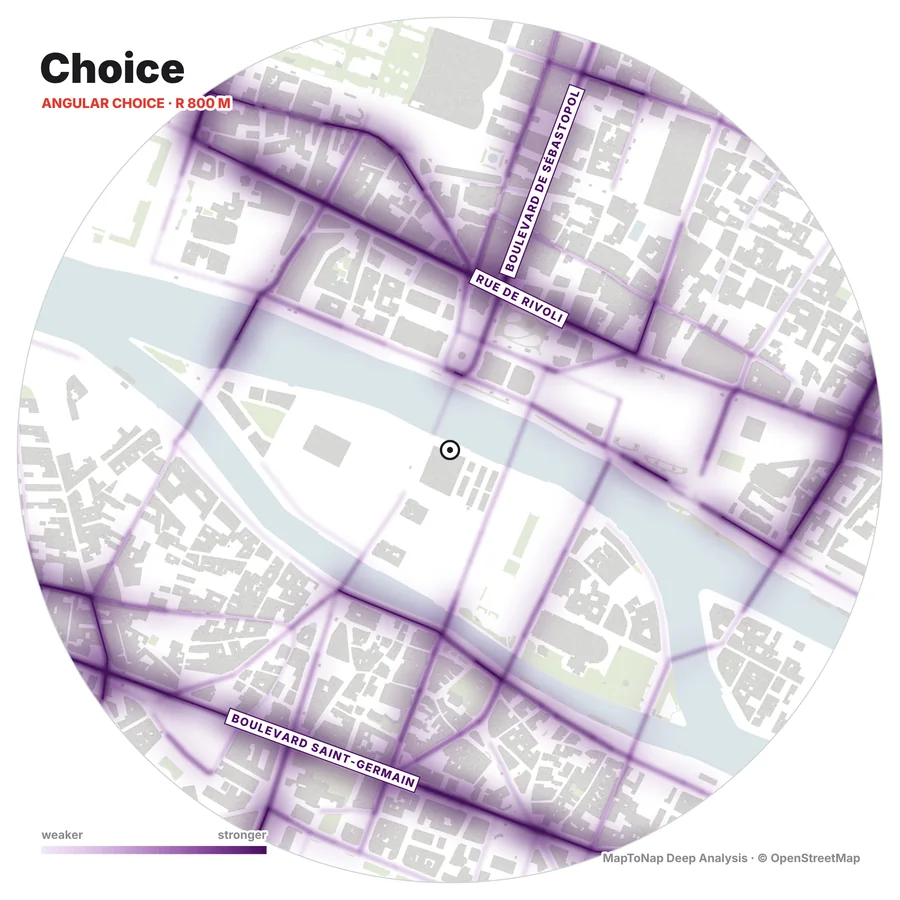
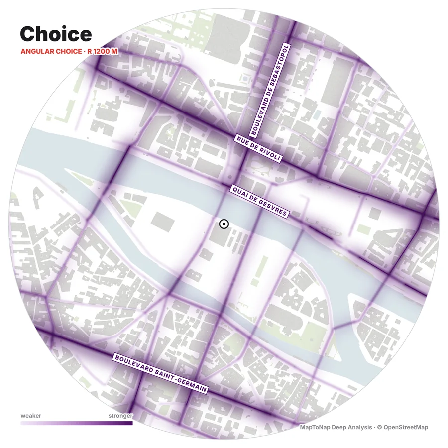
How often a street lies on the simplest route between two others: the through-routes. Drawn in purple, so the two maps read apart on one board.

Tap any street

Tap a street to read its rank among the streets on the map, and see where the street at your site stands. Save the map as a PNG up to 2400 px.

Examples

Central Paris at three radii

Computed in MapToNap around Pont au Change, Paris. At 400 m the strength is spread over many short streets and the bridges; at 800 and 1200 m it gathers on the long routes: Rue de Rivoli, Boulevard de Sébastopol and Boulevard Saint-Germain.

Map data © OpenStreetMap contributors, available under the Open Database Licence. The images are MapToNap output.

How it works

From street centre lines to integration and choice

Read the network

Streets within 1.5 km are read from OpenStreetMap and split into segments between junctions. Footpaths, service roads and tunnels are left out; only the connected network is kept.

Weight the turns

Moving from one segment to the next costs the turn angle, 90° counting as one step. The radius is measured along the streets.

Normalise

NAIN = NC1.2 / (TD + 2)
NACH = log(CH + 1) / log(TD + 3)

Normalised as proposed by Hillier, Yang and Turner (2012), so different radii and places can be compared.

Frequently asked questions

Clear answers before you start

What is space syntax?

A set of theories and measures, developed by Bill Hillier and Julienne Hanson at UCL from the 1970s, that relate the layout of streets and spaces to how people move through them. Its best-known measures are integration (how easy a street is to reach from all the others) and choice (how many routes pass through it). Well-integrated streets tend to carry more people and attract shops.

What exactly does MapToNap compute?

An angular segment analysis of the street centre lines from OpenStreetMap. Each street is split into segments between junctions; moving from one segment to the next costs the turn angle (90° counts as one step). For every segment, the shortest angular routes to all segments within a metric radius give integration and choice, normalised as NAIN = NC^1.2 / (TD + 2) and NACH = log(CH + 1) / log(TD + 3), after Hillier, Yang and Turner (2012).

Which radius should I use?

400 m reads the neighbourhood at walking scale, 800 m the district, 1200 m the wider town. Comparing the three shows whether a street is locally important, important across the district, or both.

How is this different from DepthmapX?

DepthmapX is a desktop program in which you draw or import an axial or segment map and run many kinds of analysis. MapToNap reads the street network for you from OpenStreetMap and runs one well-defined analysis, angular segment integration and choice, in the browser in a few seconds. It is a quick, consistent first reading for a site analysis; for research you can still take the same site into DepthmapX.

Is it free?

The space syntax study is part of Deep Analysis, which is included in MapToNap Max. Every Deep Analysis study, space syntax included, is free to try on the Paris sample without an account.

How accurate is it?

It is as complete as OpenStreetMap is in that place. Streets are read to 1.5 km so the edge of the map does not distort the result. Footpaths, service roads and tunnels are left out, and pedestrian streets are kept. Check the network against an aerial photo where the map is thin.
Related tools

Continue the same site analysis