Home / Architecture tools / Sun path diagram generator
Sun path diagram generator

Sun path diagrams for site analysis, set to your site’s latitude

Pick a site and MapToNap plots the sun’s path across the sky for the June solstice, the equinoxes and the December solstice, with sun positions every two hours, solar noon and the direction of the noon shadow. It is the sun diagram every site analysis needs, drawn in the same graphic language as the rest of your set.

Any latitudeSolstice + equinox arcsEditable SVGPro analysis
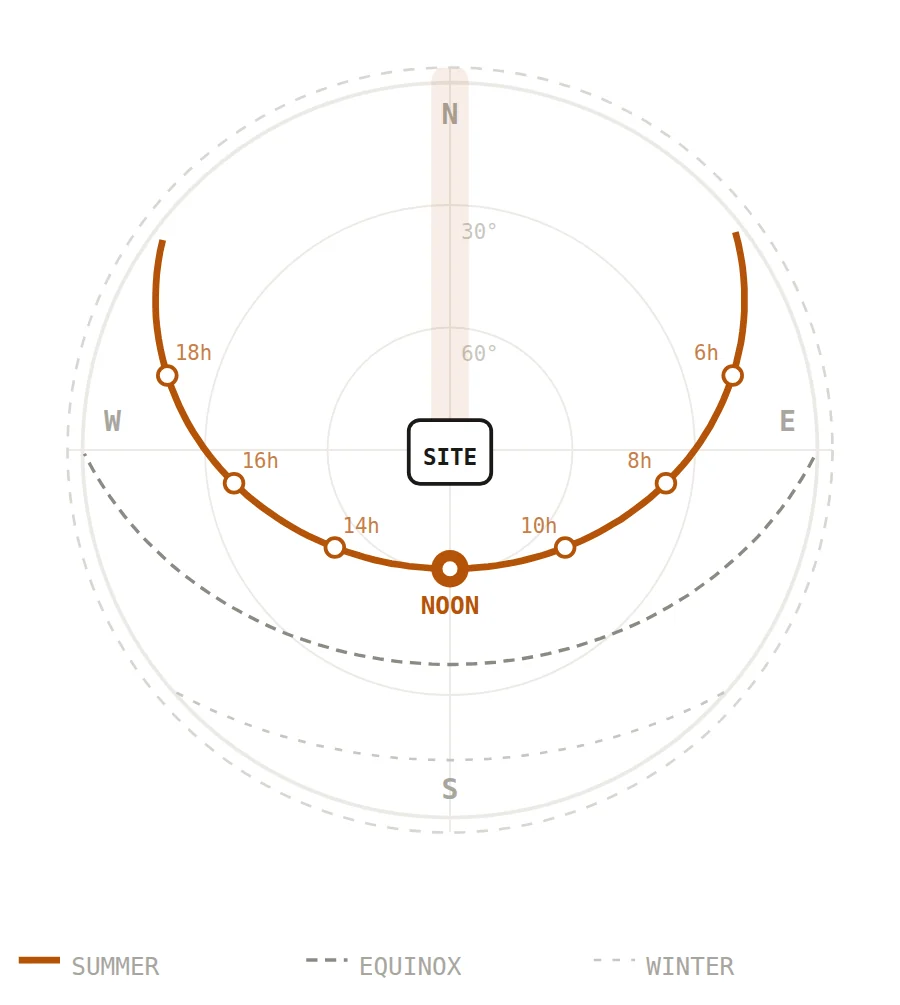
Sun path diagram for Berlin, 52.5 degrees north, generated in MapToNap
What you get

What the generator does

Calculated for your site

Solar altitude and azimuth are computed from the latitude of the point you pick, so a site in Oslo and a site in Rome get visibly different arcs.

Reads like an architectural drawing

North at the top, altitude rings at 30° and 60°, the summer arc emphasised and markers from 6 h to 18 h, in the same style as the other MapToNap diagrams.

Works south of the equator

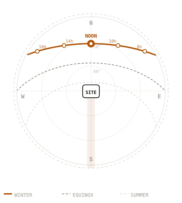
In the southern hemisphere the arcs swing to the north, and the legend swaps summer and winter to match.

Examples

Same tool, three latitudes

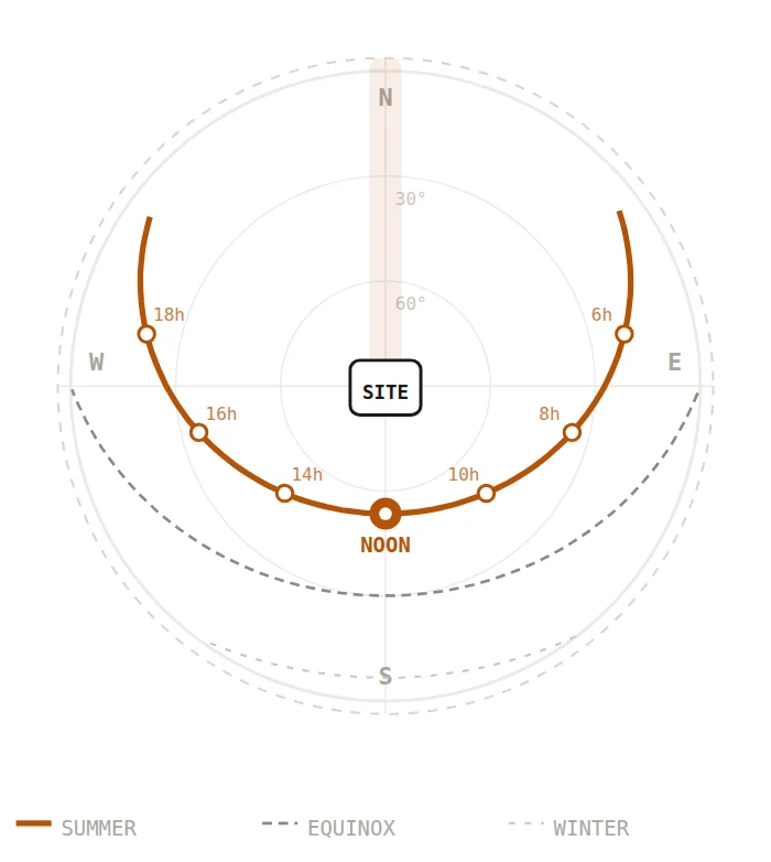
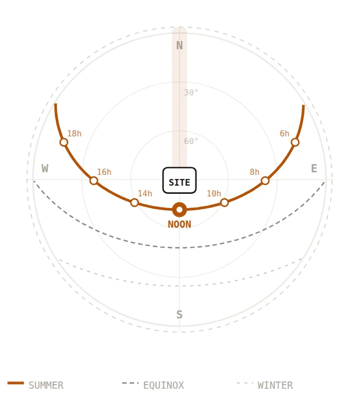
Rendered by MapToNap for three cities. The higher the latitude, the lower and longer the arcs.

Sun path diagram for Oslo, 59.9° N
Oslo · 59.9° NSummer sunrise far to the north-east; in December the sun barely clears the horizon.
Sun path diagram for Rome, 41.9° N
Rome · 41.9° NThe summer noon sun stands at about 71°, the winter one at about 25°.
Sun path diagram for Sydney, 33.9° S
Sydney · 33.9° SSouthern hemisphere: the sun passes to the north, so the arcs flip.

Map data © OpenStreetMap contributors, available under the Open Database Licence. The drawings are MapToNap output, shown as flattened previews.

How it works

Three steps, no tracing

Pick the site

Search an address or click the map. The diagram follows the latitude of the point you choose.

Turn on Sun Path & Wind

The sun path is a Pro analysis. Add any other site studies to the same set if you need them.

Generate and export

Choose a colour scheme and export an editable SVG, a vector PDF or a PNG.

Frequently asked questions

Clear answers before you start

What is a sun path diagram?

A plan projection of the sky. The outer ring is the horizon, the centre is straight overhead, and each arc traces the sun through one day. Architects use it to judge orientation, where overshadowing will come from and which façades get low morning or evening sun.

Which dates are shown?

The June solstice (around 21 June), the March and September equinoxes, and the December solstice. North of the equator these are labelled summer, equinox and winter; south of it, summer and winter swap.

How accurate is it?

It uses a standard solar geometry approximation and shows solar time, so 12 h is solar noon, not clock noon; time zones and daylight saving can shift clock time by an hour or more. That is fine for concept design and site analysis boards. For daylight, shading or energy compliance, use a dedicated simulation tool.

Does it include shadows from surrounding buildings?

No. The 2D diagram shows the sun’s path and the direction of the noon shadow only. The 3D workspace in Max lets you move the sun through the day over the massing of the real site.

Is the sun path diagram free?

The sun path is part of Pro. The free version covers the figure–ground, street network, land use and green & water drawings, with a watermark.

Can I edit the diagram?

Yes. The SVG export is vector geometry you can restyle in Illustrator, Affinity or Inkscape. A vector PDF and a PNG are also available.